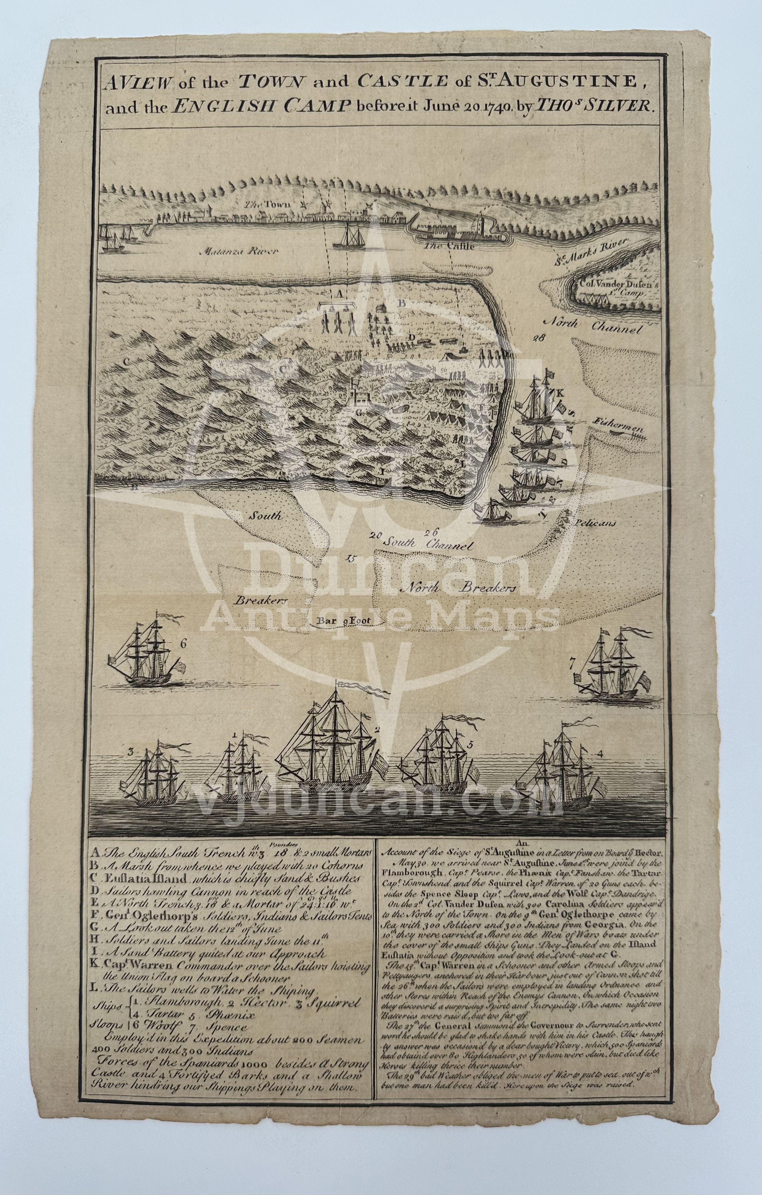


THOMAS SILVER 1740 GENTLEMAN’S MAGAZINE A VIEW OF THE TOWN AND CASTLE OF ST. AUGUSTINE FLORIDA
THOMAS SILVER 1740 GENTLEMAN’S MAGAZINE A VIEW OF THE TOWN AND CASTLE OF ST. AUGUSTINE FLORIDA
Original 1740 Copperplate Engraving, from The Gentleman’s Magazine
Published 1740.
Map by Thomas Silver
Published by Edward Cave/Sylvanus Urban
An illustrated map showing the town and castle of Saint Augustine and the English camp on its outskirts and intended path during the War of Jenkins’ Ear, a battle between Spain and Great Britain that the British ultimately lost and which forced them back into Georgia.
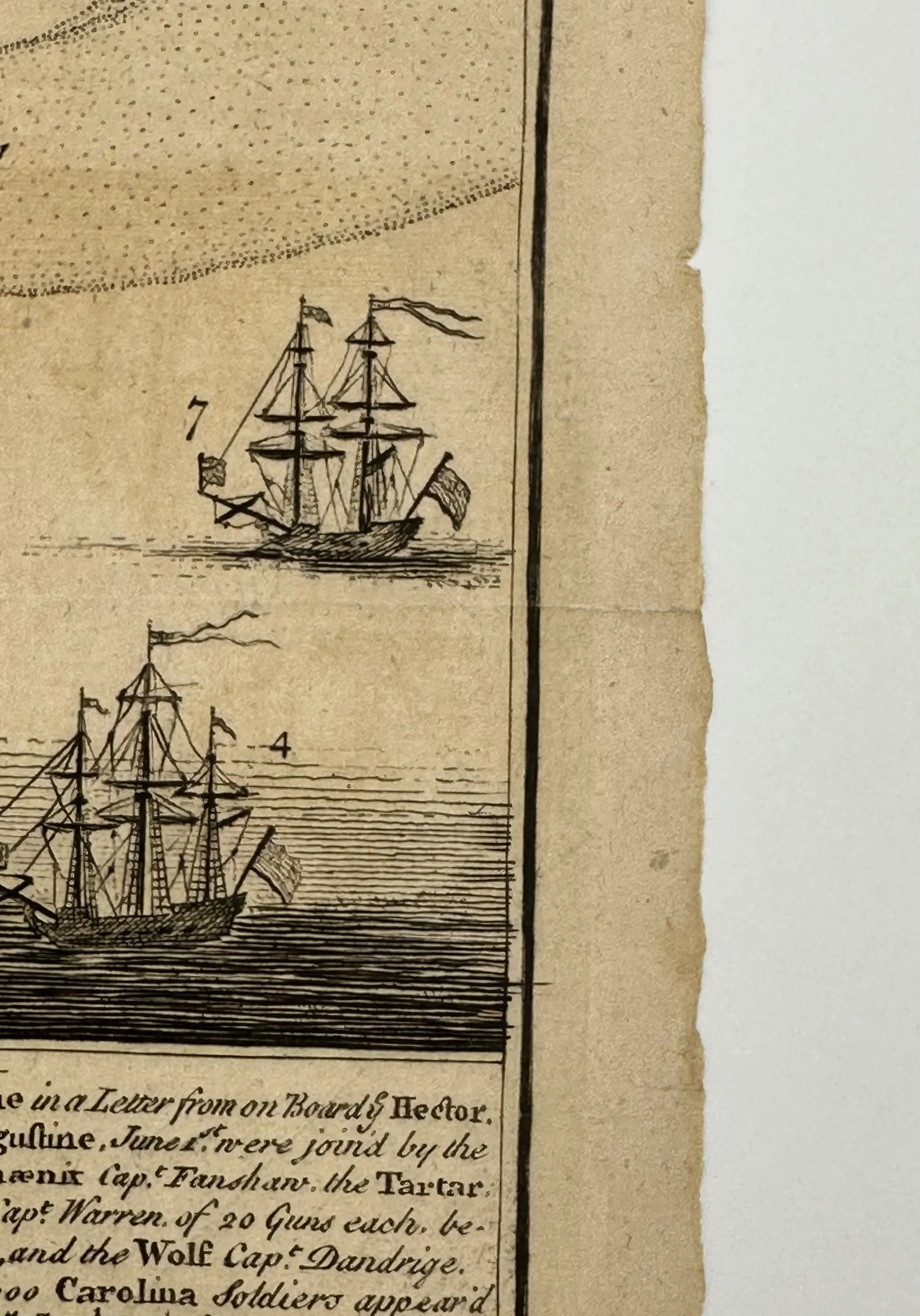
This map is not “new” or in “new condition.” This is an antique map and the quality of that will be reflected in the work. It was printed in 1740 and is in good condition considering its antique age. The full page measures approx. 7.5”L x 12”W and shows some signs of worn edges and aging. This map is a folding map and sports two creases approximately a third of the way in on either side. The bottom crease has a tear in the right margin, which has been photographed for your convenience.
The map pictured is the one that you will receive.
The first periodic publication ( one posted on a consistent schedule ) to ever use the word magazine as its current use, derived from the French word for storehouse, The Gentleman’s Magazine was created as a collection of all sorts of topics and potential interests of the educated public. There were a variety of contributors, from those who worked on it consistently and with every publication, to those who came in for a one off issue. Founded in London, England in 1731 by Edward Cave, who edited the publication under the alias “Sylvanus Urban”. Contributions to the publication often came in the form of letter written submissions, all addressed to Mr. Urban. A businessman in his own right, Cave had no difficulty distributing the publication throughout the English speaking world. The publication flourished for almost two hundred years, eventually shuttering its doors for regular production in September of 1907.
All items listed are from V&J Duncan in Savannah, GA. The shop began in 1983 with one tabletop of antique maps and has grown into a vast collection of old engravings, mezzotints, lithographs, photographs, old books, and antique prints. We have prints of architectural interest, birds, animals, botanicals, fashion, sporting scenes and tens of thousands of portraits. Our inventory also includes views and maps of Savannah and other cities, all U.S. states and most countries of the world. Visit us in Savannah, Georgia, or shop inventory here online.
All prints are rolled and shipped in a poster tube. Smaller prints will be shipped in a rigid media mail folder.
THOMAS SILVER 1740 GENTLEMAN’S MAGAZINE A VIEW OF THE TOWN AND CASTLE OF ST. AUGUSTINE FLORIDA
Original 1740 Copperplate Engraving, from The Gentleman’s Magazine
Published 1740.
Map by Thomas Silver
Published by Edward Cave/Sylvanus Urban
An illustrated map showing the town and castle of Saint Augustine and the English camp on its outskirts and intended path during the War of Jenkins’ Ear, a battle between Spain and Great Britain that the British ultimately lost and which forced them back into Georgia.
This map is not “new” or in “new condition.” This is an antique map and the quality of that will be reflected in the work. It was printed in 1740 and is in good condition considering its antique age. The full page measures approx. 7.5”L x 12”W and shows some signs of worn edges and aging. This map is a folding map and sports two creases approximately a third of the way in on either side. The bottom crease has a tear in the right margin, which has been photographed for your convenience.
The map pictured is the one that you will receive.
The first periodic publication ( one posted on a consistent schedule ) to ever use the word magazine as its current use, derived from the French word for storehouse, The Gentleman’s Magazine was created as a collection of all sorts of topics and potential interests of the educated public. There were a variety of contributors, from those who worked on it consistently and with every publication, to those who came in for a one off issue. Founded in London, England in 1731 by Edward Cave, who edited the publication under the alias “Sylvanus Urban”. Contributions to the publication often came in the form of letter written submissions, all addressed to Mr. Urban. A businessman in his own right, Cave had no difficulty distributing the publication throughout the English speaking world. The publication flourished for almost two hundred years, eventually shuttering its doors for regular production in September of 1907.
All items listed are from V&J Duncan in Savannah, GA. The shop began in 1983 with one tabletop of antique maps and has grown into a vast collection of old engravings, mezzotints, lithographs, photographs, old books, and antique prints. We have prints of architectural interest, birds, animals, botanicals, fashion, sporting scenes and tens of thousands of portraits. Our inventory also includes views and maps of Savannah and other cities, all U.S. states and most countries of the world. Visit us in Savannah, Georgia, or shop inventory here online.